


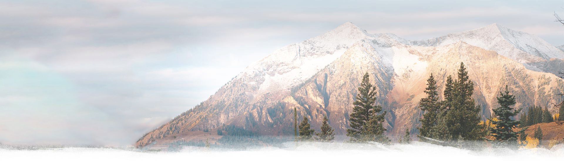
17 Feb Austrian Alps: Via Ferrata Zugspitze (B)
Zugspitze is the highest peak in Germany located at the southern border with Austria. Basically you can ascend the peak from many sides either by foot or by cable car. The most popular routes are from Germany on the North-Eastern side or on the Western side from Austria. Both routes have a cable car and both can also be covered by foot. We chose to go from the Austrian side and also make the Via Ferrata Zugspitze (the German name is STOPSELZIEHER). The difficulty on the Austrian side is classified as B and it is really easy. The only hard thing is the ascent of more then 2000 vertical meters in roughly 6 kilometers. The German via ferrata is harder, ranked at C, and also longer, but that is a plan for the future.
Distance
11 Km
Total Time
7 h 20 min
Active Time
6 h 05 min
Vertical Relief
+2092 / -2092 m
Min/Max Altitude
1209 – 2959 m
Ferrata Grade
Easy
Via Ferrata Zugspitze
For the whole duration of the holiday we hunted for good weather in order to ascend on Zugspitze. Since we were about to mark the highest peak in Germany we didn’t want to be surrounded by clouds. The weather forecast predicted a good time for the next day and as such we planned an early morning start.
The phone alarms were set for 5:30 AM but unfortunately at 4 AM a large band of noisy mountaineers ruined our sleep already. Eventually we fell back asleep but had a hard time waking up. We started the hike at 7 AM right next to the cable car station in Obermoos at 1225 meters.
There are multiple signs pointing in the right direction – it should be easy to get orientated. The start is on footpath 801, located on the right side of the cable car. The path is wide but it is also steep.


The first stop / waypoint is the Wiener Neustädter Hütte at 2213 meters. The first section of the ascent is on the shaded part of the mountain. It is a continuous sustained climb so the early start and low temperatures were really a bless.
The next section is traversing a scree field. There used to be a footpath at some point but now the moving rocks have engulfed everything. Two steps up, one step down – we were sweating like crazy! At this point we were walking for over an hour and no sign of the hut yet. After the scree field the next sector is a crossing that somewhat goes ‘around’ the mountain.
Finally we have the hut in sight at 2213 meters. Above it there is a line of people, at least 30 men strong, that is slowly moving up on the footpath. Short break at the hut for hydration, equipping gear, food and toilette. To this point we had a good pace, 2 hours for 3.6 kilometers and about 1000 vertical meters.


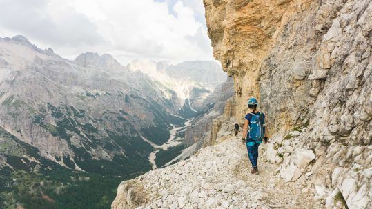
After the hut there is a mild ascent, some scree and the large group of people, waiting at the start of the ferrata. For the first few sections we didn’t clip in as the steel cables are not really mandatory. The rock is dry and offers good grip. We were in que as the next section is traversing a hole in the mountain where water is dripping on the rocky path. No possibility to overtake so we went slow and steady with the crowd.
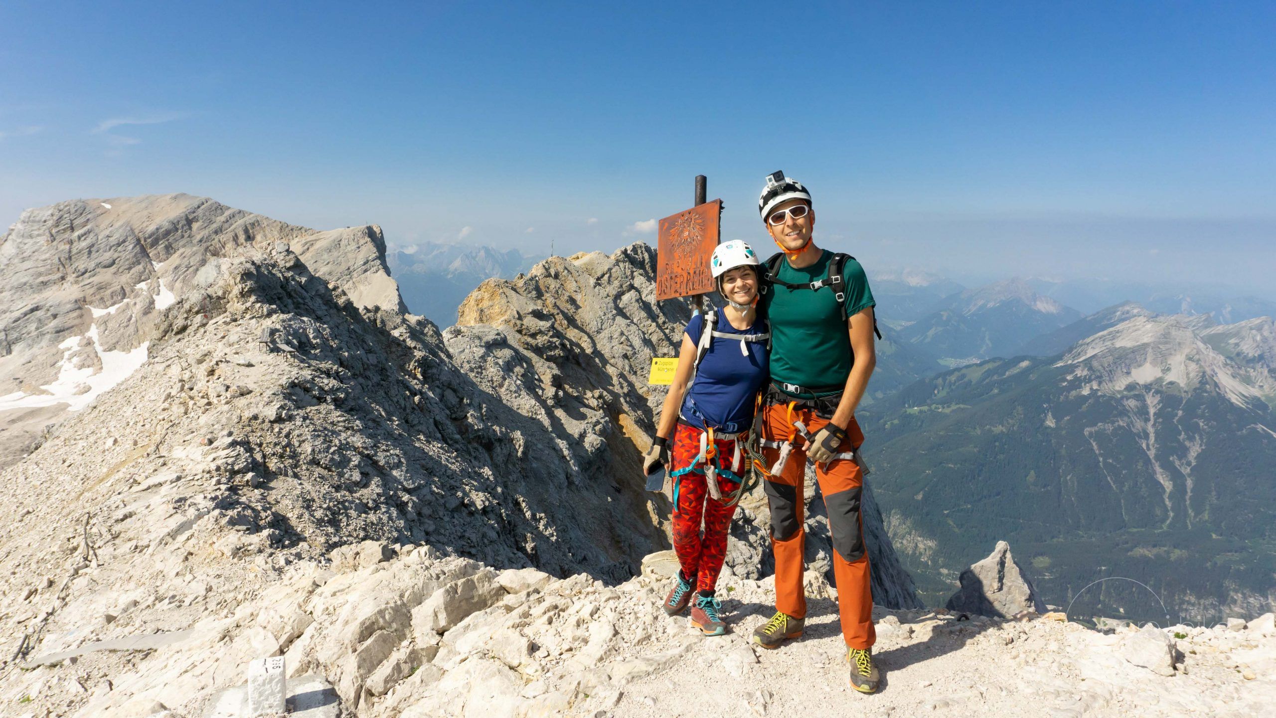
As we emerged from the cave we saw the group in front of us making slow progress. Since the rock was in great state and there were ample stable holds, both for the feet and for the hands, we decided to unclip and climb the mountain in parallel to the group. There were low chances to dislocate rocks as the side of the mountain was pretty compact. With this approach we did great progress. I can say this was up to date my fastest ascent yet. In short time we were ahead of the group and the remaining track was relatively desserted.


Reaching 2800 meters we started to feel a bit of a headache and to be slightly tired. Until we reached the peak we had a few more via ferrata sections and a few parts that are not assured. Mostly we carried the via ferrata kit without using it. Only seldom did we clip in, where we saw real danger in case of a misstep. Nevertheless this was our situation. We would strongly recommend that you carry it with you especially in case of bad weather or of rain. The slippery rock can pose difficulty in some sections. You know… better safe then sorry!
The journey to the peak took us 4 hours and 20 minutes, a lot faster then we would have expected. The sign down in the valley estimated it at about 6 hours. If you clip on the ferrata and if you take into account the large number of tourists then the estimation is relatively correct. Overall we were satisfied.


From the valley and from multiple other view points during the track the peak (Zugspitze) seemed smaller then the other surrounding mountains. Only when we actually reached next to it we saw it was the highest in the region, Pretty deceiving perspective.
Reaching the peak platform I was slightly disappointed. The place look more like a faire, with tons of people cramped close together. Lots of people in flip-flops, crappy souvenirs, fast food and a continues uproar. In order to reach the monument on the peak and take a few pictures people (mostly in sandals) were waiting in que or were pushing and showing. At some points it was even scary to look at these people as some almost slipped into oblivion. We decided to skip it all together.
We took two coffees and enjoyed the sunny weather at almost 3000 meters. At times it felt chilly but overall the weather forecast did not lie.


On the top you can visit two museums: one dedicated to ice crystals (very small place) and another dedicated to the history of the cable car. Both are included in your cable car ticket or can be bought separately at 4 EUR a piece.
To finish off in style we then descended the peak by cable car (about 30 EUR per person). For us this one of the best things, because we can skip the knee pain of the descent. Absolutely excellent.


To summarize for the record: we reached the highest peak in Germany, Zugspitze; we did the via ferrata (B difficulty grade) but we mostly walked in parallel to it; we saw the small remnants of the glacier and we visited two cute museum on the peak. I call it a great day!
As a general remark – it is advised to have an early morning start and in regards to the via ferrata, don’t stress about it. On the top be prepared to tap your patience if you want to reach the monument. Overall there are multiple routes to reach the mountain top, which you choose depends on your timeframe, logistics and on the weather.


GPS track Via Ferrata Zugspitze
How to get to Via Ferrata Zugspitze?
From Innsbruck the easiest way to reach the Austrian base of the Zugspitze peak is to follow highway A12 in the direction of St Anton am Arlberg. At Mötz you need to get on road 189 and at Dormitz on road 179. Follow it all the waz Lermoos. From here follow the sign to Obermoos or to the Tiroler Zugspitzbahn.
Where to sleep?
If you plan to ascend Zugspitze from Austria then the best place to camp is at Zugspitze Resort. This is a 5 star camping located right next to the Tiroler Zugspitzbahn cable car and to the start of the hike. It is one of the best camping we have ever visited and it also not really expensive, 34 EUR per bight for two persons. During our visit they were expanding the resort and many things were closed, like the spa, aquapark and main hotel area, but they should be operational by now. There is also the possibility to book a room in the hotel if that is more down your alley.
The best thing about the camping is the utilities building. You have access to huge personal bathrooms, that come packed with a large sink, mirror, blow drier, a couch for your things and a big stand-in shower. Furthermore you have access to a large, shared, fully equipped kitchen which also has a lot of table spaces to eat. In the laundry room you will find all the equipment required and also a place to dry your clothes. There’s also a place to keep your ski shoes / hiking boots warm or to dry them overnight. Everything is very clean and top notch condition. The camping pitches are cute also, spacious and with enough intimacy. There’s also a big plus in what concerns the price you pay and the facilities you have access to. Definitely it’s THE place to stay if you’re around. Heck, if you’re not around, find a reason to be around and camp there! 🙂

Good to know
Check the weather forecast before planning the hike. You don’t really want to get stuck up on the mountain during a lightning storm. Usually the weather is much more stable during the first part of the day so we recommend to have an early start. Otherwise you might find yourself engulfed in clouds by the time you reach the peak.
You can pack a pretty light backpack for the trip as you have two places along the route that serve food and beverages. One is Wiener Neustädter Hutte, roughly half way and the other is on the peak. Here you have many options to choose from.
Even though we did not use it, we strongly recommend having a full via ferrata kit with you. In bad weather it is a must.
If you sleep at the specified camping you don’t need to worry about parking your car as it is included in your stay.


Hope you found the information helpful and accurate, but remember, if you have any questions drop them in a comment below!
Other great adventures
-
Transylvania MTB Ride: Sirnea
If you’re planning to visit Transylvania, particularly Brasov area and you’re also looking forward t...
-
Cycling around Dracula’s Castle – Piatra Craiului National Park
Dracula's Castle, an international landmark, is probably one of the most visited places in Romania ...
-
Italian Dolomites: Via Ferrata Giovanni Lipella (4C)
Via ferrata Giovanni Lipella is one of the most emblematic routes in the Dolomites. Not only are the...
Sorry, the comment form is closed at this time.